
HIKING TRAILS
CERVERA DEL MAESTRE
The diverse variety of natural and cultivated landscapes that make up the municipal area are the perfect place for walkers who seek peace and quiet. With an area of 94 km2, the irregular and rugged land of Cervera is the perfect environment for enjoying leisure activities in the middle of nature.
In this vein, there are 6 routes covering every nook and cranny, showing all the natural and cultural attractions, but above all the beautiful countryside of Cervera.
The exceptionally well sign-posted hiking trails are divided into the following 2 blocks:
HIKING TRAILS

Hiking trail 1, El Colomer (2 km) 
RThis is an easy and very short hiking trail crossing Mount Colomer, next to Cervera, and from its scenic viewpoint you can see fantastic panoramic views of the municipality./p> Go to Wikiloc Download Route
Hiking trail 2, La Rourera (8.5 km)
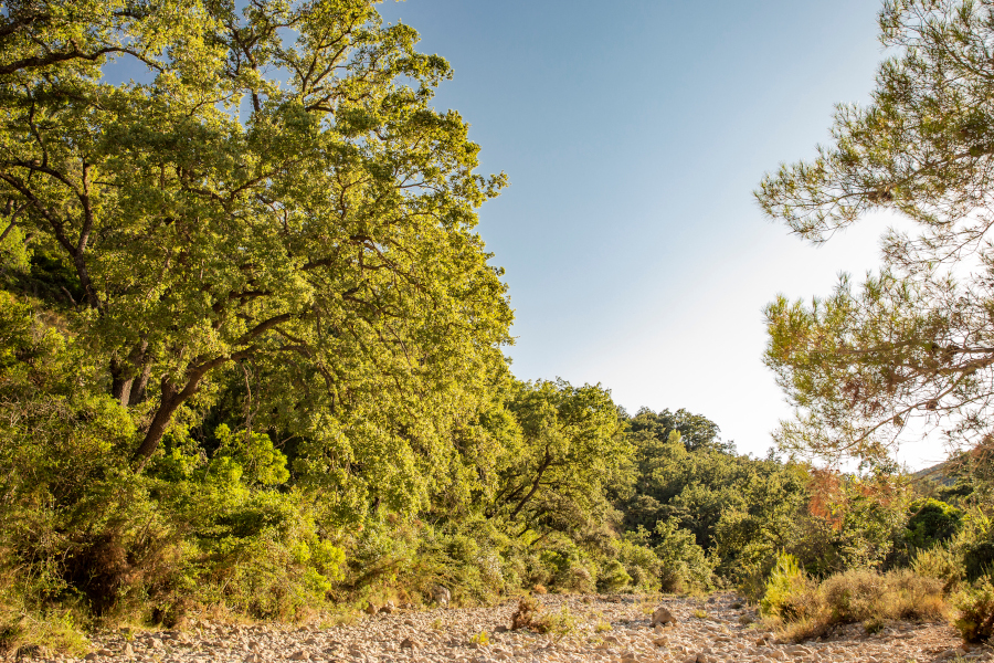
Hiking trail 2, La Rourera (8.5 km) This runs through the southern sector of the municipality; along narrow cobbled paths, passing the Llacuna cistern, where you have a fantastic view of the region, to the natural beauty spot of La Rourera, comprising mostly Valencian oak trees, and then the Malentiu well, with a recreational area.
Go to Wikiloc Download RouteHiking trail 3, Mas d’en Pere (9 km)
Heading towards San Mateo, once you have passed the Fuente de la Cerverola and a section of the Rambla de Cervera, take the Comunyé path up to Antabart square, from where you can already see the town, then descend along the old cobbled path of Mas d'en Pere.
Go to Wikiloc Download RouteINTERPRETIVE ROUTES

Interpretive Route 1, Monumental Trees (10 km)
A unique route that offers you the chance to visit the most unique living monuments in our area. The thousand-year-old olive trees and monumental carob trees are renowned in Cervera for the fact that they are mostly cultivated on terraced land, forming a curious symbiosis on the edge of the dry stone terraces.
Go to Wikiloc Download RouteInterpretive Route 2, Dry stone (14 km)
This route can be followed on foot, by bicycle or even by car, and takes in the most emblematic constructions made from this ancient art. Les Forques or Maset Houses, together with the terraced slopes of La Torn or La Llaude, show how in the past man needed to modify entire landscapes to adapt the rugged mountain into land which was suitable for cultivation.
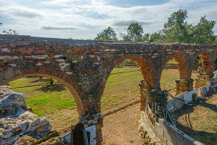
Go to Wikiloc Download ruteInterpretive Route 3, Water (85 km)
The main subsoil water extraction systems, whether for agricultural or industrial use, are mostly concentrated in the Barranco del Alba (ravine). Waterwheels, aqueducts, irrigation ditches, wells, ponds, and above all the curious natural landscape of l’Albereda, formed with common elm trees that require high water densities.
Go to Wikiloc Download Route